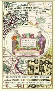
Oxfordshire 1611 - 1836 - Fold Up Map that features a collection of Four Historic Maps, John Speed's County Map 1611, Johan Blaeu's County Map of 1...
392 kr
392 kr
Tidligere laveste pris:
398 kr
Fr., 13 juni - to., 19 juni
Sikker betaling
14 dagers åpent kjøp
Selges og leveres av
AdlibrisProduktbeskrivelse
Artikkel nr.
44ced5be-a304-5390-94d1-c4141794517f
Oxfordshire 1611 - 1836 - Fold Up Map that features a collection of Four Historic Maps, John Speed's County Map 1611, Johan Blaeu's County Map of 1...
392 kr
392 kr
Tidligere laveste pris:
398 kr
Fr., 13 juni - to., 19 juni
Sikker betaling
14 dagers åpent kjøp
Selges og leveres av
AdlibrisLignende toppselgere

POP MART Labubu The Monsters – Exciting Macaron Blind Box 17 cm Vinylfigur | Samleleke | Designerfigur | Originalt produkt
249 kr

POP MART Labubu The Monsters Big into Energy 17 cm
249 kr
")
1 stk POP MART Labubu 3.0 Big into Energy Blind Box-figur – The Monsters Vinyl Plysch Hänge 17 cm (tilfeldig farge, enkel pakke)
249 kr

Labubu The Monsters Macaron Blind Box fra POP MART
259 kr
")
1 stk POP MART Labubu 2.0 The Monsters Macaron Blind Box Plysjfigur (tilfeldig farge, 17 cm, generasjon 2, 1-pakning)
249 kr

Øreputer for Bose QuietComfort - QC35/QC25/QC15/AE2 Hodetelefoner Svart
99 kr

POP MART Labubu The Monsters – Big into Energy Series Blind Box 17 cm Vinylfigur | Samlefigur | Designerleke | Originalt produkt
249 kr
")
1 kpl POP MART Labubu The Monsters Spennende Macaron Plysjfigur leketøy Blind Box (tilfeldig farge, 17 cm, 1 pakke)
239 kr

INF TYPE-C Dual SD/TF-kortleser for rask dataoverføring 0
99 kr
Tidligere laveste pris:
107 kr

3-Pak - Fidget Spinners med Sugekopp for Barn
119 kr
Tidligere laveste pris:
139 kr
Anbefalinger til dig

Microfiberklud PVAmicro 38x35cm grøn,5 stk/pk
308 kr

Silikontape / Plaster for Arr – Behandling av arr
99 kr

Luftrenseenhet - Renser / Saniterer luften - 20,000 mg/h
599 kr

6x60ml = 360ml - Kirkland Extra Strength 5% Men Hair Regrowth 60ml Hair Loss
1 390 kr

Universallader for Garmin klokker Svart
89 kr

Hundetrimmer / Potetrimmer - Trimmer for Poter
199 kr
")
Afnan Supremacy Collector's Edition Eau De Parfum 100 ml (man)
687 kr

Dansende kaktus, snakkende kaktusleke gjentar det du sier
160 kr
Tidligere laveste pris:
234 kr

G9 LED-lyspærer – Varmhvit – 10stk
119 kr

10x Premium hjørnebeskyttelse og kantbeskyttelse for barn
119 kr
Tidligere laveste pris:
146 kr