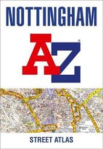
Nottingham A-Z Street Atlas
171 kr
171 kr
To., 15 mai - on., 21 mai
Sikker betaling
14 dagers åpent kjøp
Selges og leveres av
Adlibris
Produktbeskrivelse
Printed in full-colour, paperback format, this atlas contains 74 pages of continuous street mapping.
The main mapping extends beyond central Nottingham at a scale of 4 inches to 1 mile, featuring postcode districts, one-way streets, park and ride sites, and safety camera locations. Areas covered include:
- Arnold
- Beeston
- Burton Joyce
- Calverton
- Carlton
- Clifton
- Cotgrave
- Eastwood
- Heanor
- Hucknall
- Ilkeston
- Keyworth
- Long Eaton
- Radcliffe on Trent
- Stapleford
- West Bridgford
Separate coverage of Bingham is provided.
The large-scale street map of Nottingham city centre - at a scale of 8 inches to 1 mile - includes:
- Postcode map of the Nottingham area
- Road map of the Nottingham area
- Nottingham Express Transit map
A comprehensive index lists streets, selected flats, walkways and places of interest, place, area and station names. Additional healthcare (hospitals, walk-in centres and hospices) and transport connections (Nottingham Express Transit) are indexed as well.
Artikkel nr.
936bf467-7414-4fb7-98f0-47f2c25f567e
Nottingham A-Z Street Atlas
171 kr
171 kr
To., 15 mai - on., 21 mai
Sikker betaling
14 dagers åpent kjøp
Selges og leveres av
Adlibris
Lignende toppselgere

Øreputer for Bose QuietComfort - QC35/QC25/QC15/AE2 Hodetelefoner Svart
99 kr

Rengøringsklud, Vileda PVAmicro, 38x35cm, blå
297 kr
Tidligere laveste pris:
314 kr

4-Pak - Tesla Senterkopper - Bil Svart/silver
129 kr

Anti-snork Bånd / Magnetiske Plaster - Stopper snorking
149 kr

Sangean MMR88 sveivradio med lommelykt, solcelle, USB, gul/svart
1 169 kr

Rengøringsklud, Vileda PVAmicro, 38x35cm, rød
297 kr
 - Spillekonsoll - 1TB SSD NVme - Wi-Fi/LAN - Hvid")
Sony | Playstation® 5 Slim (Digital-versjon) - Spillekonsoll - 1TB SSD NVme - Wi-Fi/LAN - Hvid
5 933 kr

Microfiberklud PVAmicro 38x35cm grøn,5 stk/pk
298 kr
Tidligere laveste pris:
315 kr

INF TYPE-C Dual SD/TF-kortleser for rask dataoverføring 0
99 kr
Tidligere laveste pris:
107 kr

Luftrenseenhet - Renser / Saniterer luften - 20,000 mg/h
599 kr
Anbefalinger til dig

Universalfjernkontroll BN59-01312A for Samsung Smart 4K LED Svart No Voice
129 kr
Tidligere laveste pris:
145 kr

Geberit AquaClean Avkalkingsmiddel 4 stk
461 kr

PS4-kontroller DoubleShock Wireless
349 kr

Plenlufter - Piggsko for å lufte plenen
269 kr

Toppik - 27,5g - Black - Svart
285 kr

Universallader for Garmin klokker Svart
89 kr

Shark FlexStyle 5-in-1 style & hårtørrer - Champagne Sjampagne
2 528 kr

2-pakning iPhone 11 altskjermbeskytter i herdet glass
79 kr

4-Pak - BMW Senterkopper - Bil 68 mm
129 kr

Trådløs CarPlay-adapter 2025
449 kr
Tidligere laveste pris:
459 kr