Birmingham: A History in Maps
362 kr
362 kr
Tidligere laveste pris:
367 kr
To., 19 juni - ti., 24 juni
Sikker betaling
14 dagers åpent kjøp
Selges og leveres av
AdlibrisProduktbeskrivelse
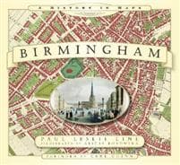
From the exceptional town plans and maps contained within this unique volume emerges a social picture of Birmingham; a town quickly developing in size and population in the eighteenth century; along with the changes brought about by urbanisation. Land was bought up for development; hundreds of ‘courts’ were built to home the industrial workers pouring in from the many outlying villages. The many gardens, orchards and wide expanses of open space detailed on Wesley’s 1731 plan of Birmingham were soon to be transformed into a sprawling mass of habitation. By 1765 Matthew Boulton, a leading entrepreneur and pioneer of the Industrial Revolution, had built his famous Soho Manufactory on Handsworth Heath. Shortly afterwards, the town plans of Birmingham in the first quarter of the 1800s chart the arrival of the railway; a plan from 1832 is the last glimpse of the city before the arrival of the Grand Junction Railway and other main line stations. Accompanied with informative text and pictures of the cityscape, the many detailed plans contained in this historic atlas of Birmingham are a gateway to its past, allowing the reader and researcher to visually observe the journey of this historic town to city status in 1889 and beyond.
Artikkel nr.
0b918639-3490-4602-813c-04bd2a134e7a
Birmingham: A History in Maps
362 kr
362 kr
Tidligere laveste pris:
367 kr
To., 19 juni - ti., 24 juni
Sikker betaling
14 dagers åpent kjøp
Selges og leveres av
AdlibrisLignende toppselgere

POP MART Labubu The Monsters – Exciting Macaron Blind Box 17 cm Vinylfigur | Samleleke | Designerfigur | Originalt produkt
249 kr
")
1 stk POP MART Labubu 3.0 Big into Energy Blind Box-figur – The Monsters Vinyl Plysch Hänge 17 cm (tilfeldig farge, enkel pakke)
249 kr

POP MART Labubu The Monsters Big into Energy 17 cm
249 kr

POP MART Labubu The Monsters – Big into Energy Series Blind Box 17 cm Vinylfigur | Samlefigur | Designerleke | Originalt produkt
249 kr
")
1 stk POP MART Labubu 2.0 The Monsters Macaron Blind Box Plysjfigur (tilfeldig farge, 17 cm, generasjon 2, 1-pakning)
249 kr

Labubu The Monsters Macaron Blind Box fra POP MART
259 kr

Øreputer for Bose QuietComfort - QC35/QC25/QC15/AE2 Hodetelefoner Svart
99 kr
")
1 kpl POP MART Labubu The Monsters Spennende Macaron Plysjfigur leketøy Blind Box (tilfeldig farge, 17 cm, 1 pakke)
239 kr

Pop Mart Labubu Stitch Sleep Snack Series
349 kr

Pop Mart Labubu Zimomo enkelin riipus 17,5 cm
349 kr
Anbefalinger til dig

INF TYPE-C Dual SD/TF-kortleser for rask dataoverføring 0
99 kr
Tidligere laveste pris:
107 kr

3-Pak - Fidget Spinners med Sugekopp for Barn
119 kr
Tidligere laveste pris:
139 kr

Luftrenseenhet - Renser / Saniterer luften - 20,000 mg/h
599 kr

6x60ml = 360ml - Kirkland Extra Strength 5% Men Hair Regrowth 60ml Hair Loss
1 390 kr

Universallader for Garmin klokker Svart
89 kr

Hundetrimmer / Potetrimmer - Trimmer for Poter
199 kr
")
French Avenue Liquid Brun Eau De Parfum 100 ml (man)
483 kr
Tidligere laveste pris:
513 kr

Dansende kaktus, snakkende kaktusleke gjentar det du sier
160 kr
Tidligere laveste pris:
234 kr

G9 LED-lyspærer – Varmhvit – 10stk
119 kr

10x Premium hjørnebeskyttelse og kantbeskyttelse for barn
119 kr
Tidligere laveste pris:
146 kr