Children's Illustrated World Atlas
249 kr
249 kr
Tidligere laveste pris:
252 kr
Ti., 6 mai - fr., 9 mai
Sikker betaling
14 dagers åpent kjøp
Selges og leveres av
Adlibris
Produktbeskrivelse
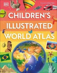
Take young readers on the ultimate round-the-world trip with this impressive atlas - packed full of beautiful illustrations and photographs.
Discover the world map-by-map with this exciting world atlas book for children, featuring more than 50 maps! Each page is filled with fascinating information, facts and colourful illustrations of our world.
Children aged 9-12 will love to learn all about the many countries, cultures and people of the world through vibrant maps. Fascinating facts, local stories, vivid pictures, and clear, satellite-based maps together make this atlas a global yet personal experience for young readers.
This illustrated atlas book for children offers:
- Bite-sized information giving the profiles, facts, stats and flags of every country.
- Pictures and stories explaining the society, culture and history of each region.
- Maps created using satellite imagery providing a clear view of the world map-by-map.
- A variety of topics covered, including population density, wealth, and internet access shown through graphics.
From Bangkok's floating markets to the carnival in Venice, the Children's Illustrated World Atlas brings together views from windows all over the world. This illustrated atlas not only portrays regions, such as the Siberian wastes, with beautifully detailed maps but also describes the peoples who live there.
Artikkel nr.
a7295cf5-04dd-4605-871f-bd7abf926068
Children's Illustrated World Atlas
249 kr
249 kr
Tidligere laveste pris:
252 kr
Ti., 6 mai - fr., 9 mai
Sikker betaling
14 dagers åpent kjøp
Selges og leveres av
Adlibris
Lignende toppselgere

Anti-snork Bånd / Magnetiske Plaster - Stopper snorking
149 kr

4-Pak - Tesla Senterkopper - Bil Svart/silver
129 kr

Øreputer for Bose QuietComfort - QC35/QC25/QC15/AE2 Hodetelefoner Svart
99 kr

Luftrenseenhet - Renser / Saniterer luften - 20,000 mg/h
599 kr

Hundetrimmer / Potetrimmer - Trimmer for Poter
199 kr

Rengøringsklud, Vileda PVAmicro, 38x35cm, blå
299 kr

Universallader for Garmin klokker Svart
89 kr

RCA til HDMI Converter 1080p - Adapter
139 kr

SERO Apple Macbook magsafe 2 lader, 60W - for Macbook Pro 13" m. Retina skjerm
349 kr

Trådløs CarPlay-adapter 2025
449 kr
Tidligere laveste pris:
459 kr
Anbefalinger til dig

Plenlufter - Piggsko for å lufte plenen
269 kr

4-Pak - Volkswagen VW Senterkopper - Bil 65 mm
129 kr

Astronaut Night Light / Galaxy Lampe med fjernkontroll - Nepula Starry Sky Projector
329 kr
Tidligere laveste pris:
499 kr

INF Etterfilter til Dyson V11 / V15 akselstøvsuger 3-pakning
229 kr

SERO Apple Macbook magsafe 2 lader, 45 W - for Macbook Air
399 kr

3-Pak - Fidget Spinners med Sugekopp for Barn
179 kr
 - Spillekonsoll - 1TB SSD NVme - Wi-Fi/LAN - Hvid")
Sony | Playstation® 5 Slim (Digital-versjon) - Spillekonsoll - 1TB SSD NVme - Wi-Fi/LAN - Hvid
5 852 kr

INF Filter for MSPA oppblåsbare bassenger FD2089 4-pakning
299 kr

INF Hjulmutterhette med fjerningsverktøy, 20-pak 21 mm
95 kr

Digital vekt - lommevekt, smykkevekt 0,01 - 200g
119 kr